
In 2024, the world recorded over 14 million dengue cases and more than 10,000 deaths. Puerto Rico declared a public health emergency in March after cases exceeded anything in recent history. Meanwhile, somewhere in a research lab, someone had the brilliant idea of combining GPS tracking, smartphone apps, and community health workers into a mosquito-hunting dream team. Welcome to the future of dengue control, where your phone might save more lives than your doctor.
The Problem: Mosquitoes Are Winning
Let's talk about Aedes aegypti - the mosquito with a taste for human blood and a habit of spreading diseases like dengue, Zika, and chikungunya. This tiny terror has adapted beautifully to urban life. It breeds in standing water (that tire in your backyard, the vase on your neighbor's porch, the clogged gutter you've been ignoring), bites during the day, and prefers hanging out near humans.
Traditional mosquito control goes something like this: wait for people to get sick, figure out where the cases are clustering, send in fogging trucks, hope for the best. By the time you've identified a hotspot, the virus has already spread to new areas. It's like fighting a fire by responding to smoke - you're always one step behind.
What if we could flip that script? What if instead of reactive mosquito control, we had real-time surveillance that predicted outbreaks before they happened and targeted interventions to the exact locations where they'd do the most good?
That's the promise of GIS-integrated mobile platforms for dengue control, and studies like NCT07201116 are testing whether this promise translates into reality.
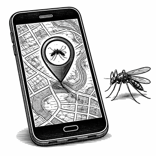
GIS: Your GPS, But For Public Health
Geographic Information Systems (GIS) are basically sophisticated mapping software that lets you layer different types of data onto a geographic framework. Want to know where dengue cases are appearing? Plot them on a map. Want to compare that to rainfall patterns, population density, or the locations of known mosquito breeding sites? Layer those on top.
The magic happens when you start seeing patterns. Maybe cases cluster near certain water sources. Maybe outbreaks follow flooding events with a predictable delay. Maybe there's that one neighborhood where, despite spraying three times already, the mosquitoes keep coming back because nobody cleaned up the construction site.
GIS takes the chaos of public health data and organizes it spatially, revealing connections that would be invisible in a spreadsheet.
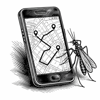
Mobile Platforms: Taking GIS to the Streets
Here's the problem with traditional GIS: it lives on powerful computers in air-conditioned offices. The people actually doing mosquito surveillance - community health workers going door to door, inspecting properties, setting traps - often work with paper forms and clipboards. By the time their observations get digitized and analyzed, days or weeks have passed.
Mobile GIS platforms put the power of mapping technology directly in the hands of field workers. Using tablets or smartphones equipped with GPS, they can:
- Record the exact location of mosquito breeding sites
- Document trap installations and spray operations
- Report case findings in real time
- Receive targeted assignments based on current priority areas
- Navigate to specific locations that need attention
The data flows instantly to central systems where analysts can update maps, identify emerging hotspots, and redirect resources on the fly.
Real-World Example: Puerto Rico's 2024 Response
When Puerto Rico's 2024 dengue outbreak exceeded 6,000 cases - shattering historical records - health officials deployed an integrated GIS approach that showcases what's possible.
Vector control teams used ArcGIS Field Maps and Survey123 on mobile devices to manage trap installation and document spraying operations. ArcGIS Workforce automatically generated daily assignments, telling each technician exactly which traps needed maintenance and where new installations were needed.
Behind the scenes, analysts used Python scripts and geoprocessing tools to identify optimal locations for surveillance traps based on multiple factors - population density, environmental conditions, historical case data. The system geocoded trap locations and automatically loaded priority sites into field workers' daily assignments.
The result? A coordinated response where resources flowed to the highest-risk areas, field teams knew exactly where to go, and leadership could track progress in real time. It's dengue control as logistics problem, and logistics is something we're actually good at.
Machine Learning Enters the Chat
Modern GIS-integrated dengue surveillance doesn't just track where outbreaks are happening - it predicts where they'll happen next.
A study in Punjab, Pakistan used machine learning models including Random Forest, Light Gradient Boosting, and Support Vector Machine to predict disease spread based on environmental variables. The Random Forest model achieved 93.97% accuracy in predicting outbreak locations.
Key predictive factors include:
- Temperature (mosquitoes love warmth, but not too hot)
- Precipitation (rain creates breeding sites)
- Humidity (affects mosquito survival and behavior)
- Population density (more humans = more transmission)
- Historical case data (past outbreaks predict future ones)
combining these factors in predictive models, public health teams can shift from reactive to proactive. Instead of waiting for the hospital reports to come in, they can preemptively treat areas before outbreaks begin.
The mHealth Revolution in Vector Control
Smartphone apps for dengue control go beyond just mapping. Consider the "Mozzify" platform, which uses an algorithm based on clinical diagnosis guidelines to analyze whether users experiencing symptoms should seek hospital care. The app sends alerts and displays maps showing current locations and nearest hospitals.
Other platforms gamify mosquito surveillance, encouraging citizens to report standing water or potential breeding sites. User reports get instantly geotagged and added to surveillance maps, crowdsourcing surveillance to thousands of additional eyes.
For community health workers, purpose-built apps can guide standardized data collection, ensure consistent methodology, and even provide training materials in the field. When everyone's using the same platform, data quality improves and analysis becomes more reliable.
The Evidence Base
A scoping review of GIS applications in dengue surveillance identified 64 peer-reviewed studies published between 2015 and 2024. The most frequently used platforms were ArcGIS and QGIS. Risk mapping and hotspot detection were the most common applications, followed closely by vector control monitoring.
Studies from Nicaragua, Peru, Brazil, and across Southeast Asia have demonstrated that GIS-based surveillance systems help public health workers identify high-risk areas more accurately and target interventions more effectively. In resource-limited settings - exactly where dengue burden is highest - these tools can maximize the impact of limited vector control resources.
A randomized controlled trial in Peru found that mobile phone-based health interventions significantly improved households' preventive behavior in dengue-endemic areas. When people receive location-specific, timely information about dengue risk, they're more likely to take protective actions.
Why This Matters Now
Dengue is expanding into new territories as climate change pushes Aedes aegypti into previously temperate regions. The economic burden on healthcare systems and communities through lost productivity runs into billions of dollars annually. There's no widely available vaccine for most of the population, and no specific treatment once you're infected.
Vector control - killing mosquitoes and eliminating their breeding sites - remains the primary prevention strategy. Making that vector control more efficient, more targeted, and more data-driven could save thousands of lives and millions of dollars.
GIS-integrated mobile platforms represent a relatively low-cost technological intervention that can amplify the effectiveness of existing resources. You don't need to hire more health workers if the ones you have can work smarter. You don't need more insecticide if you're spraying exactly where it matters.
The Challenges Ahead
Technology alone won't solve dengue. These platforms require:
- Reliable internet connectivity in field conditions
- Training for community health workers who may not be tech-savvy
- Sustained funding for software licenses and device replacement
- Integration with existing health information systems
- Political will to act on the data collected
There are also privacy concerns about tracking disease cases with GPS precision. Stigma can attach to communities identified as "high risk," and there are legitimate questions about how location data is stored and used.
But these are solvable problems, not fundamental barriers. As mobile technology becomes more ubiquitous and affordable, and as GIS platforms become more user-friendly, the path forward gets clearer.
The Bottom Line
The fight against dengue is partly a fight against chaos - the chaos of disease spreading faster than information, of resources deployed where they're not needed while hotspots go untreated, of disconnected data sitting in silos while outbreaks rage.
GIS-integrated mobile platforms bring order to that chaos. They connect field observations to analytical systems in real time, turn geographic patterns into actionable intelligence, and put precise targeting tools in the hands of the people doing the actual work.
It turns out there really is an app for fighting mosquitoes. And in the global battle against dengue, that app might be more powerful than any insecticide we've invented.
References:
-
ClinicalTrials.gov Identifier: NCT07201116 - GIS-Integrated Mobile Platform for Dengue Control
-
Leveraging geographic information system for dengue surveillance: a scoping review. Tropical Medicine and Health. 2025;53:45. DOI: 10.1186/s41182-025-00783-9
-
Combating Dengue in Puerto Rico with GIS. ArcNews Spring 2025. ESRI.
-
Chang AY, et al. Combining Google Earth and GIS mapping technologies in a dengue surveillance system for developing countries. Int J Health Geographics. 2009;8:49. DOI: 10.1186/1476-072X-8-49
-
Dammert AC, et al. Preventing dengue through mobile phones: Evidence from a field experiment in Peru. J Health Econ. 2014;35:147-161. DOI: 10.1016/j.jhealeco.2014.02.002
Disclaimer: This blog post is for informational purposes only and does not constitute medical advice. Always consult with a qualified healthcare provider regarding any medical conditions or treatments. Clinical trial results may not reflect individual outcomes. Images and graphics are for illustrative purposes only and do not depict actual medical devices, procedures, mechanisms, or research findings from the referenced studies.